Showing posts with label Greg. Show all posts

Wednesday, November 9, 2011

The Hundred Mile Hike


North South Trail, North End 31 Miles...Outcast Total Miles: 1219.04
Canal Loop Trail 11 Miles
North South Trail, North End 31 Miles
North South Trail, From Golden Pond to Sugar Bay and back 28 Miles
Total Miles 101

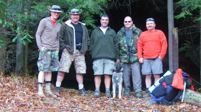
I am writing this story with a lot of pride. Six years ago, Troy asked me to hike with him. He had been reading my hiking stories and had done some backpacking before. He told me then, that if we ever went over five miles a day that he would just have to back out. He had bad knees. Last year he asked me what the longest hike that I had ever been on and I told him seventy miles. He said that he wanted to do one hundred.....I said OK! Marco started five years ago and had never backpacked before. Not to mention that this is the most distance that Greg and I had ever done. I am proud of my fellow backpackers!

We headed out with the plan to place a car at the South end of Land between the Lakes and start hiking from Golden Pond going North. We were going to hike to the North end, do the Canal Loop and then hike to the South end of the North/South trail.

Day one:
We got on the trail at noon. Right off the git go Greg saw a green snake crossing the trail. The wildlife was on. When we took a break, I sat on a log and leaned against the tree behind me. The tree fell over. The entertainment was on. We made it to Rhodes Bay the first night. As we were setting up camp the owl started talking. All night long the wildlife continued. We had owls talking, Coyotes calling, and deer blowing. Not much sleep the first night.

Day two:
We got to see our first Eagle before we left camp. The Seagulls also came in that morning. Blisters on feet and chaffing were the topics today. We have never had major issues with this before and now three of us had issues on the second day of a hundred mile backpack. Not Good!

We made it to Smith Creek for the night. As we were making camp a deer hunter came to visit us. Four of them were hunting the field 100 yards from us. That is why we were in the orange. We got baths in the creek and another great campfire. We were entertained by a screech owl and the coyotes. The owl would screech and the coyotes would yelp. They sounded like hyenas so we figured the owl would wait until they got settled and then screech. The coyotes would laugh and say "you got us" and then they would do it all over again. All night long.

Day Three:
We woke up to a thunderous "CRACK". What the hell? I looked over and the fire was going. Greg had broke a branch off a fallen tree that made so much noise it scared him. Greg got up every morning and got a fire going. Then he would wake us up so we could get on the trail at daylight.

We took our lunch on Pisgah Bay. We had a nice beach, the sun was shining, and we were airing out the equipment. We set up our hammocks and got a nap in. Life was good!

From there we hiked to just short of Moss Creek Day use area and set up on the bay. Once again the Hooters and Screamers at night. Another evening of sitting around the campfire telling lies and taking cough medicine. Sometime after Troy had gone to bed he came bounding out flashing his light through the woods. He said he heard man size critters in the leaves. We looked around and decided it was probably a coyote.

Day Four:
Troy woke us up. You have about twenty minutes before the thunderstorm comes in. We got up and made sure everything was set up good. We ate breakfast and got the fire going good. We went back to bed as the rain started and the major storm blew by. The only casualty was Greg's sleeping bag got wet. He would spend the next two days trying to dry that out.

We got on the trial facing gentle Gail force winds as we walked the riverside. The trail had spots that felt like quicksand with the mud. When we dried out our stuff at lunch time, we could barely hold on to put them on the clothes lines because of the winds. We had to find shelter behind a fallen tree to eat our lunch. COLD!

We hiked the Canal Loop Trail around by the North Bridge. At break we argued about what day it was. My watch was off by one day. Troy pointed out that in a couple of days we would be starting our five day hike not counting the first five days.

We made camp just before Nickell Branch Backcountry Area. It was a misty and foggy night. Right at dusk some bikers went by. The first people we saw on the trail. The campfire would keep the mist off us but you got wet every time you went to the hammocks. I went for a swim in the bay. It felt good to get clean. In the fog I could almost hear the Jaw's music and the bell ringing on the buoy. Quick swim!

We listened to the owls and coyotes again. Marco and I stayed up late with our cough medicine talking. The moon was trying to shine through, but no luck.

Day Five:
It was a misty morning. We jumped up alot of deer today. We stopped by the North Welcome Station to check on the springs on the South end of the North/South trail. Not good news. They were dry. There were some hunters there that were camping in the area. We noticed as we were standing there in our shorts and short sleeves that they had long pants and heavy coats on. Must be Southerners.

We set up and dried out at lunch. Still overcast and Greg was still trying to dry out that sleeping bag. We made camp at the far end of Pisgah Bay. We had a good fire and it was dry enough to clean some clothes. That night some hikers came down the trial as we were going down for the night. Two had headlamps on and I could see the backpacks. They were hunters coming in for the night. Marco said that he saw four hikers. I told him that he was drunk. We teased each other for the night.

Day Six:
Greg had gotten up in the middle of the night as his wet sleeping bag had let him down. He got the fire going to warm up. Marco got up with him thinking it was morning. After some time he asked Greg what time it was. He said three thirty. What??? They both went back to bed.

The next morning as we headed out we passed a tent with three backpacks next to it. The Hunters were by the lake trying to warm up around a fire. Another hunter with a backpack was on the trail. I guess I was the drunk last night. I did not see the other two hikers which did not have headlamps on.

We had a great day to dry up equipment today. Greg's bag finally dried out. We were going to set up camp by Sugar Bay camping area. It was packed full of hunters. They had cases of beer and the foam shooting targets. We decided to move on and made camp at Higgins Bay. There was a small house boat in the bay and two campers on the other side of the bay. We spent the night listening to the owls and coyotes.

Day Seven:
The two campers across the bay had been singing Marine songs, so first thing in the morning Greg went to visit them. He found out that they were Army aircraft mechanics. They were having a very cold morning. Their gear had gotten wet during the night and they were shivering. One had spaghettio stains on the shirt where his can had blown up on the fire. We heard the screaming last night.

We passed some bike riders on the trail. The first one put his hand out like he wanted a high five? Greg wasn't sure what to think about that and when he passed me I was thinking, that would be stupid.

We passed an older gentleman that we had seen on the trail up North. This time he had his dog in his backpack. He was 81 years old and he was section hiking the trail. He had his wife with him this time. He had been doing twenty two miles a day. WOW! He is the man.

Now the challenge for the trip. I had to get the guys past the car. We got to the car to resupply and all was well. We saw another ranger and he too said that the springs on the South side were dry. Our plans had to change. We went and got the car from the South Welcome station and brought it up to Golden Pond. We needed twenty seven point six miles. It was fourteen miles to Sugar Bay. We headed out.

We set up camp around Bush Arbor Camp. We were just about out of food when we made it to the car. Now we were all overweight with too much food for this part. Troy popped out the first surprise, apple rice pudding for all. We did the owl coyote thing again and just added deer. There were some headlights out in the woods off a distance. We figured that it must have been some hunters gutting a deer.

Day Eight:
We got up and on the trail. We were headed for Sugar Bay. I told Greg when we got to where we ate lunch yesterday, stop and get my clothes line. I forgot it. We also agreed to stop at the spring that we got water at the day before.

We took lunch at Higgins Bay. This is where Troy broke out the second surprise and made brownie's on the trial. He is the man! Tessa had put the brownie's in the bag with a note for all.

After lunch Troy headed out saying he would see us in a while. When we got packed up Greg headed out after him. Greg is always in the front! Marco and I caught up with Greg his head hanging low. He couldn't catch up to Troy and had to quit. We found Troy at Sugar Bay laying on a bench waiting for us. Greg had to pay him homage as he was the hiking king. We had a celebration at this point because now all we had to do is hike back to the car. We had done it.

We hiked back to Higgins Bay, where we took a break. I said it would sure feel good to go swimming, when I heard the splash. Troy was in. Before long we were all in. Only sixty degree water, so we cooled off fast. We decided to stay here the night and hike out in the morning. Another peaceful night of Hooters and Screamers. We never did find that spring we were looking for.

Day Nine:
This was it. We hiked out and completed One Hundred and One miles of trail. We stopped by the last campsite and picked up Marco's stakes for his hammock on the way.

Pictures:

Sunday, October 17, 2010

Longhunter V


Long Hunter.........................Trail Rating.............Outcasts Total: 903.38 Miles
Volunteer Trail...6.0 Miles.........Easy
Day Loop............2.0Miles..........Easy
Volunteer Trail...6.0Miles..........Easy
Day Loop............2.0Miles..........Easy
Total………………16.0 Miles

Of the many many people that said that they were going to show up and start hiking with us this year, the original outcasts were the only ones at the trail head this year to start the annual beginning of the season hike.

Greg and Troy were talking about their lightweight backpacks and passing them around. They had made some progress!

The four of us and Shadow headed out. We had some gentle gale force winds blowing, but the temperature had not dropped out the bottom of the thermometer yet. The trees were showing color and there were areas of yellow leaves that we got to hike through.

The trip to camp was pretty much uneventful as we basically walked and caught up on where we were in our lives. For some reason my recent marriage was brought up alot. Not really sure why, but it provided entertainment.

We had gotten on the trail by 10am and figuring that we would be first to camp being a Friday, we were surprised to see a hammock hanging in camp along with a number of coolers. Well, surprise to me and Marco....... Craig had taken his boat to the camp and brought beer and burgers. LIFE IS GOOD! This also explained why Greg and Troy's packs were so lightweight.

Greg not only showed off his new Crocks, he showed us how he can collect fishing lures with them. Cool new benefit. Thinking about a new pair myself now.

There might have been some cough medicine taken while the burgers cooked and we suffered through another survival camp as the season began.

After the campfire got going Greg provided us with much entertainment as we worked out our sides with laughter. We had a peaceful night except when an owl did a little screeching and flew through camp. The next morning we headed out.

Pictures:

Thursday, January 14, 2010

Sheltowee Trace Part III


Day One.......4.3 Miles......Easy.........................Outcast Total:792 Miles
Day Two......11.1 Miles......Difficult
Day Three.....8.4 Miles......Difficult
Day Four.....8.15 Miles......Difficult
Day Five.....1.75 Miles......Easy
Total........33.7 Miles

Crazy, Insane, Lost your mine, what the h___? Just a few of the things we heard as we carried our packs out through the snow to the truck. Yes, there were two inches of snow on the ground in Kentucky and another inch falling while we drove to the trail head. Troy, Greg, Marco, and I headed out. Shadow was left behind because of the snow, which would mean wet dog for five days. She made her point as she tore something up every day that Troy was gone. Shoes, trash, another shoe, something every day.

Well on the way to Kentucky I had to explain to the guys that they had nothing to worry about. Yes, we were driving through snow, but the further north we go the warmer it gets. I told them that we would be driving out of the snow. Well when we got to Corbin, the snow had stopped. We went to a Wendy's for lunch which was a mistake. The guys saw that Corbin had a Holiday Inn Express. So every time the trail got hard they reminded me that they had a blue card and platinum card and Corbin had a Holiday Inn Express. Yes, I heard that alot.

We drove up to Holly Grove Marina wwwhollybayMarina.com to start this hike. Randy, the manager, was planning on picking us up and bringing us back to the Marina on day five. There was plenty of snow when we got there and the lady at the office was very polite as she never called us nuts to our faces. We dropped off the truck keys, picked up our packs, and started hiking.

The scenery was beautiful with the fresh coat of snow on the ground. We made it North of Laurel Lake by Road 775 when we called it a night. The snow fell as we made camp and got a fire going. The trail up to this point had been gentle rolling hills and well marked. Make sure that you take a left and the North end of the lake and don't go over the earthen dam. It's not marked.

We got done with dinner and tried to stay warm by the fire. The guys made fun of me for sitting barefoot by the fire. They were still in the learning process of becoming Outcast tuff. Some lies were told and cough medicine was taken.

We were woke up at one point in the night by a couple of coyotes that were celebrating a kill. Everyone but Marco got to hear them. It brings one to immediate attention even from a dead sleep. During one of those many bathroom breaks in the middle of the night, I saw a million bright stars shining down on the new inch of snow that had fallen.

Greg had gotten up first and got the fire going. It was going to be another beautiful snow day to hike. We hiked into the Cane Creek Wildlife Management Area, which is a beautiful area to hike. One of the prettiest areas on this hike. It was especially cool to see all the snow on the evergreens. We got pictures of the frozen solid Van Hook water fall.

You really need the map when it comes to the road hiking sections of this trail. They are not marked very well at all. Especially when you get to a spilt in the road or have the option to go either way.

We met one of those "Road Hunters" while we walked down the road. He said that he was hunting coyotes. We figure that he was hunting anything that moved and that might also include hikers. After a short visit, we hiked down to the Big Dog Branch and camped at the campsite there. Another wonderful campsite along the creek with icicles hanging all along the other side.

We had a little trouble keeping the fire going as the wood was damp and the temperature was dropping fast. Marco impressed us again, by picking another dead branch for the bear bag. Yes, it broke again. Greg gave up and just hung his on the tree by the fire. I know it was a good five feet in the air. If a bear would have come into camp, it would have hit him on the head. His reply was that if the bear ate his food he would go to the Holiday Express.

We did some visiting and took a little cough medicine for health reasons. This was one of the 0 degree nights. When I woke up to my face hurting, I knew it was cold. I zipped up the old bag and went back to sleep. Sometime in the night, Troy heard a four legged visitor heading through camp.

We woke up to some very cold temperatures. It didn't take long to get the fire going, but it sure took a long time to get the guys away from the fire. We got a late start this morning. We started with a couple of good water crossings. One right at the camp. Luckily we didn't have to get wet. We did a little bridge building and rock placing to get us across. As soon as we crossed the first one and figured out which way to go at the split in the trail, we came to the second. This one was wider and deeper and frozen over. A little exploration and talent and we got across.

Just after the bridge on Sinking creek there is a campsite where we got a fire going for lunch. It was the longest lunch we had on this trip due to us freezing every time we stopped. The trail involved some road hiking and then headed down to Pine Creek where we had to break the ice and do some old fashion foot washing. While we were figuring out how we were going to cross, Marco changed into his crocks. I was so proud of his training. Couldn't hop this one. It did build some character. We made camp just on the other side.

We got flurries while we sat by the fire. This was one of those fires that put Marco on the second row. The tree we were sitting on had two branches. Every time the fire got up, Marco moved to the other branch because it got so hot. This was also the night that Greg made the mistake of hanging his hammock on the same tree as I did. Yes, he got to enjoy my snoring and breathing breaks. He didn't sleep all that well for some reason.

Today we had a lot of hills to climb. Just to add to the spirit, it snowed all day. We crossed the Poison Honey Fork and Hwy 80. We had a short but cold lunch on the other side down in a valley.

When we hiked down to Hawk Creek, we got to see some things! On one of the hills, we stopped for a break. Troy walked by us repeating over and over "My name is Troy, there is B shift tuff and then there is Outcast tuff!" He always comes up with something. The ice formations were wonderful as well as the frozen water fall. We also got to see the chimney rock formation.

Once you get past Hawk Creek you start doing some "road hiking". I use this term loosely cause it is mainly four wheeler trails across the top of the mountains. No sooner did we get on the road, I turn around and Marco has his pants off. I guess his zipper broke, but he wasn't scared of the cold!

There is no water there so make sure that you fill up before you leave the waters of Hawk Creek. We camped somewhere where the map shows a Laurel Branch off to the west. We never saw this branch but assume that it was down at the bottom.

Another very cold night around 0 degrees. The same guys that were making fun of me on day one about being barefoot around the campfire all had their shoes and socks off. I guess it's something that Outcasts do for comfort.

Marco entertained us with holding up his cup to wipe the snow off the bottom. When he did, he tipped it and spilled water right on top of his stove putting it out. That brought on some horse laughter. Then he tried to light it again. He ended up having to dump the water out first. We all stayed up late that night just having a good visit.

Over all our campfires claimed more equipment than ever. All of our clothing got burn holes in them. The prefilter of my water filter fell off into the fire. Greg melted the leg darn near off one pair of pants. A water bladder had a hole melted into it. My inflatable seat got two holes in it. And at the end three out of four pairs of shoes were shrunk. Guess who's wasn't......HEE HEE HEE! Oh yea, Marco caught Greg when he lost his balance and almost fell into the fire himself.

The next morning we hiked to I-75 and stopped at Spur Oil RV Park. They have a really good restaurant there where we could get some good old fashion burgers. It is a clean place that offers showers along with the fine cooking.

Arron from Holly Bay Marina picked us up there and took us to our truck. What a wonderful hike. At the end, I proved my point. The further we hiked North, the warmer it got!

Pictures:

Monday, November 16, 2009

Sheltowee Trace Part I


Trail……………Rating…………Miles…………………….Outcasts Total: 686.0
Day One:
Rock Creek Loop…..Easy…..…..2.25
Sheltowee Trace…….Easy…..….4.35
Total……………………………..6.6

Day Two:
Sheltowee Trace…….Moderate….6.44
Gobblers Arch……..Difficult….…3.86
Total……………………………..10.3

Day Three:
Sheltowee Trace…….Moderate…11

Day Four:
Sheltowee Trace……Moderate….10.9

Day Five:
Sheltowee Trace……Moderate…..5.8

Total……………………………..44.6 Miles

We knew that something was wrong when we actually slept through the night at work. What were the chances that on a planned five-day hike that a hurricane would come to Tennessee? We got up and headed to Big South Fork in the rain.

Greg, Chase, Troy, Shadow, Marco, and I were going to start the Sheltowee Trace. It is a 260-mile trail that runs from the Big South Fork to Northern Kentucky through the Daniel Boone National Forest. We had hiked the first 9.4 miles when we hiked the John Muir trail last season, so we started where we left off and took the Rock Creek Loop trail to get where we needed to start.

Troy, Marco, and I came in one car and signed us all in. Greg got caught up in traffic on I-24 so we didn’t get started until 1pm. We also did a little extra off road driving getting to the trailhead just for practice. You know the Outcast way.

The rain stayed steady as we made our way to Kentucky. This made the trail slick and added the challenge that we always like. Chase and his dad took turns trying to outdo the other with trips and falls. Chase ended up on his back one time. There was one section of trail that was completely washed out and we lost Chase and Troy to slipping and sliding. Then as Greg was attempting to cross a downed tree, he did a fancy dance which one step took out Marco’s hiking pole. He managed to stay up, but the pole was totaled.

The rain did stop by the time we got to our first stop at Great Meadow campground. We forded the river to get to it. We set up camp and Chase actually got a fire going. Some stories were told and cough medicine taken.

The fun started at bear bag hanging time. Greg, Marco, and I gathered all the food and headed to a large tree. The target was a four-inch in diameter branch about fifteen feet off the ground. After a couple of attempts we got the makeshift rope over the branch and attached the bag. The one section of rope was stretching and not sliding over the branch.. It didn’t help that we were trying to lift about two hundred pounds of food. We swapped out some rope and tried again. We finally got our food bags up where we wanted when snap…………….the whole branch broke off the tree. Well, this kinda hit my funny bone a little. The other two started laughing at me laughing and this dragged out for quite a while before we could regroup. Plan B. We found a limb on the other side and took a vote on if this branch was alive or dead. We had to use the branch that broke off to help lift the massive amount of food into the tree. We smiled with joy about the same time that the rope broke. Plan C. We used two ropes and two bear bags and life was good.

The stars came out and we had a beautiful night. Some time in the night the hurricane passed through. I woke up to the flapping of my tarp wondering what was going on. The next morning we collected the articles that had blown away in the night.

Day two started out with a ford across the river. It’s a good way to start the day and get everyone going. We hiked down to where the Gobblers Arch trail intersects. A vote was taken. The Sheltowee crosses Mark Branch numerous times. Troy said about 17 times or we could take Gobblers Arch, which is the high water route. It is described as the driest, but most difficult alternative. I got out voted so up we go. When you got to the base you could look straight up the mountainside and that was your trail. No switchbacks for the half-mile climb. Then you got a short brake before you started going up hill. It added a mile and a half to our hike and kicked some butt. We took a lunch break at Gobblers Arch.

Once we got on Divide road, we hiked the rest of the day on the road. We got our water from the Punchencamp Branch where we saw our first hunter in the woods next to a couple of caves off the North side of the road. We stopped for the night at a large rock shelter with a pool beneath it. It had been used as a campsite before.

We listened to an owl talk as we set up camp and made dinner. After the stories were told and meds taken, the bear bags were hung and everyone hit the sack. I stayed up by the fire and listened to the wildlife. It started with the frogs. They all talked at once then they all stopped about fifteen minutes later. Then the bats took off. I thought that they would come through camp and crap on me, but I just heard them all flapping at once with the high pitch squeaking. After that the birds came through camp. Not sure what they were, but they were perking like Turkeys do. After all that excitement, I went to bed.

Day three; we got off the road. A little while after the initial climb, Greg just hit his knees in the middle of the trail. We assumed that it was time to pray, but we found out that he just fell over a hole in the trail. Then while on break Marco took a picture of Troy and the truth was caught on film. You could actually see Troy’s pack refilling with the lightweight fairy dust that we had all heard about. Lots of climbing today until we finally reached the top with a rock climb and wonderful view.

After we reached the top and ripped our shins on the thorn bushes, we started down. We did some more road hiking and then headed on down to Grassy Creek where we did a little bathing and airing out of the tents and hammocks.

After the break we headed back up the mountain to go back down the mountain and after many creek crossings we went on to the crossing of Big Creek. We got some pictures of Troy carrying Shadow across the creek. The trail then climbs up to and we cross the Yamacraw Bridge. We camped just on the other side of the bridge at a campsite by the Big South Fork Cumberland River.

Greg made connections to get picked up here in the morning. His back was acting up and he had a serous foot injury that let him know that it was time to call it quits. Luckily it happened by a good road and easy to find location.

Stories where told and cough medicine taken by the fire. At bear bag time Chase headed out to a tree to hang their bag. Shortly after he left, we heard some screaming and hollering going on. We all ran to see what had happened to Chase, when in his light beam you could see two sets of eyes bouncing down the trail toward him. What the ___? When they finally came into the light of the other headlamps, you could see that they were two dogs and with the screaming had finally pulled of course and headed through the woods. That was exciting. A short time later we saw some lights up on the hillside and knew that they must have brought the dogs. The people never came down or hollered at us. The lights disappeared and later we could hear the dogs barking up by the parking area. Chase and I made a night hike to check things out and everyone was gone.

More cough medicine was needed. You could have used Chase to mix up drinks with all the shaking he was doing. Finally one by one everyone headed to bed.

Day four; we said our good byes to Greg and Chase and headed down the trail. We hit all the mile markers Lick Creek, Negro Creek, Cotton Creek, and Alum Ford. There is a large flat campsite just past Negro Creek. A shelter, which is not on any map, past Cotton Creek. Alum Ford is a regular campground with roads. We stopped here for lunch and hung everything out to dry. We saw two different deer during this section of the hike.

From Alum Ford we hiked on to Yahoo Falls. The actual fall was not impressive, but the rock formations were. After you hike out of the cove back to the Cumberland there is an outhouse and a flat area by the river to make camp. After this the trail doesn't have any water on it and you cannot get to the river until Big Creek. The trail is rugged in this area and the first camping spot with water is on Big Creek in a rhododendron patch. Here, there was just enough room for the two hammocks and a tent if you have a campfire.

We celebrated our last night out with an overdose of cough medicine. Marco was buzzing. I told the guys that there was good news and bad news. The bad news being that we were at an isolated part of the park, we might see a bear. The good news being that we probably won't hear it because of the river. They felt alot better after I told them that.

We got up the next morning and headed out. There were alot of water crossings and the trail was mostly uphill. We climbed uphill to the swamp and then climbed uphill after that. The area at the start of Big Creek is a waterfall that you hike behind. It is a very beautiful area with the rock formations, but we had some major tree falls in the trail. From here we hiked to 27 where we got to wait for a train before we could cross the tracks. You hike between the church and daycare up the road to get back into the woods. My folks picked us up at the 27 trailhead with some homemade apple pies. Life is good.

Pictures:

Thursday, January 29, 2009

John Muir Trail


Day 1………7.6 miles…………………………………..Outcasts Total: 468.5
Day 2……..10.9
Day 3………6.8
Day 4……..10.6
Day 5……..10.3
Total…..…..46.2 Miles
Trail rating: Moderate with the climb on rock creek trail in Pickett State Park as difficult


This is a trip that required a lot of preplanning and searching for information. The John Muir trail is not an easy trail to look up. There are actually three different John Muir trails that you will find on the computer. The other two have information all over the Internet. One problem was I have never been to the Big South Fork so I didn’t have any idea of the terrain or water situation. It came down to buying a topographical map from National Geographic and buying books. We ended up using the 3rd Edition, Hiking the Big South Fork, by Deaver, Smith, and Duncan as the best trail description.

Problem two was the crew. There were a few items that they got a hold of and would not let go. BEAR…. BEAR…. bear, FORDING rivers, and BIG hills. The length of the trail, 42 miles, was a new record for all of them to make. While I studied water sources, they studied ways to get out.

After packing, repacking, repacking, and repacking, we were ready to attempt the trail. We got off work, repacked, and hit the road. We went to Picket State Park, signed in, and dropped off one truck at the Hidden Passage trail parking. One car had headed to the Brandy Creek Visitor Center and signed us in there. Then we met at the Leatherwood Ford trailhead. We got on the trail at 12:00.

You start out crossing an old bridge over the Big South Fork Cumberland River. The panic didn’t really start until then. Yes, it was deep, but it was also almost completely frozen over. FORDING rivers? After numerous tackles and blocks, I managed to get them over the other side of the river. The first two miles were a steady climb along the riverside. After we crossed Fall Branch, we started the 400-foot climb to Angel Falls Overlook.

Greg put on a show for us; again, Marco was behind him one time and said that it was absolutely amazing to watch. He knew he saw the bottom of both of Greg’s feet at the same time at least once as he continued a tap dance along the trail.

It was an exciting climb to Angel Falls Overlook. One time we were hanging on by a cable that was mounted to the rock facing as we walked along a cliff. Another time we were climbing the rock facing where a ladder had once been, making our way through a crack in the rock facing up to the Grand Gap Loop trail. Once there, we hiked over to the Angels Falls Overlook for an amazing view.

Life was good, as everyone knew that they had conquered the first major climb. From here the trail was more rolling hills for the rest of the day. We stopped at a “Rock House” which is a rock overhang for the night. We had made 7.6 miles by 2:30. We had a good challenge collecting firewood off the side of a very steep hill. It got down to 20 degrees that night. You should have seen my bear bag. It was working with all of its might, as were Marco and I trying to hang it in the tree. It felt like 50 pounds. We weren’t going to starve on this trip!

Greg had decided to camp under the overhang that night, instead of hanging off the edge of the hill like the rest of us. Well our fire was under the overhang too. I wish I could have recorded his description of the night with his noises. Basically it started out warm and cozy. Then it got chilly, then it got cold, then he heard cracking of wood, then it got warm, then it got hot, then it got really hot, then it got warm, then it got chilly, then it got cold and started all over again.

DAY 2
We got on the trail by 7:30. After the first mile we found a bridge piled on the side of the trail with a broken sign next to it. We forded that stream. Around 10:00 we came across the first of many Hog hunters. We made our way 500 feet down to Laurel Fork passing two more hunters. We crossed Laurel Fork and stopped for lunch. We had gotten in seven miles today and I was feeling confident that we could complete the trail with no problem….. like we had a choice. We hung our stuff out to dry as we enjoyed the peaceful sound of gunshots and watching hunters walk back and forth by us. I don’t know what they would have done if they got one. It was a drag that I would not have wanted to attempt.

We crossed Parch Corn Creek at 1:15 and we wanted to get to Big Creek and ford the river before camp. We took a break at a campsite next to the Cumberland River where Marco showed off his makeshift chair. He put a board on two stumps and did his Humpty Dumpty routine. I had to take a picture before I helped him up.

We got to Big Creek at 2:30 and found that it now had a bridge over it. There wasn’t enough water in it to worry about a bridge. People were happy. We hiked up to where the trail leaves the Cumberland and came back to Big Creek to make camp. We had gotten in 10.9 miles and sat around a campfire and watched the snow as the temps dropped to 10 degrees. We just got some flurries and that was it.

DAY 3
We warmed ourselves in front of the fire on got on the trail at 9:15. Today’s goal was to get across the two biggest peaks and camp on the other side of the John Muir overlook. We started with our usual family tradition of uphill going the 400 feet up to Burkes Knob. I got pictures of the Large Chimney Rocks on the way along with the most berries I have ever seen on Holly bushes. We made it to Maude’s Crack, got some pictures, and then headed the 350 feet down to No Business Creek. We stopped at Tackett Creek for lunch with 3.2 miles under our belts.

After lunch, we started uphill the 500 feet to the John Muir overlook. We took many long switch backs, climbed a ladder, scrambled up the bluff and when the trail looked like it ended, we simply climbed straight up the sloping shelves of rock in front of us to the trail heading up. Marco and I stopped to rest as Troy came up with a big smile on his face just laughing at the easy trail I picked for him. The John Muir overlook was not as impressive as the Angels Falls Overlook, but it was impressive. We had made our goal and now just find water.

TICKS? What the ? There is ice on the ground and Marco, Greg and Shadow all got ticks. What is going on?

We stopped at a grove of hemlocks with a river and made camp. We had 6.8 miles in today with most of it up hill. It got down to 25 degrees tonight. We got a couple of sleet showers, but nothing impressive.

DAY 4
Once again we warmed by the fire. Our goal today would just be make it as far as we could. Marco started out the day by placing his oatmeal bag next to his stove. The bag caught fire. Marco grabbed the bag, which started the leaves on fire. While he was throwing his oatmeal bag into the fire, the leaf fire was working on his shoes and jacket. It was exciting to watch from across the fire.

We got on the trail at 9:00. Greg was a little or a lot concerned about the trail description I read to him this morning, mainly the water fording for some reason. Today was mainly rolling hills and we stopped for lunch just a couple of miles short of Divide Road. When we got to the road, I heard the plans that Greg and Troy had made, as this was one of their escape routes. They were still contemplating on it. After you cross the road you head into a beautiful valley following an old railroad bed along Rock Creek. This is where we found some wonderful ice sculptures and the longest icicle that I have ever seen. We hiked this valley all the way to Pickett State Park.

At one point on this section Marco lead us down the trail and down hill around a boulder. Soon after he disappeared, he came running back full speed yelling OH SH…T! You should have seen the shocked look on Greg’s face, who was right behind him. We all got a great laugh out of that one.

A little while later as things were just moving along, Troy came jogging past me doing pushups with his poles over his head. Again, he was making fun of my easy trail. Right after that the trail did a very steep climb, and I asked Troy to show me that move again. I have to give him credit, he showed out one more time. We decided to make the fording before camp again.

It was starting to get late as we finally made it to the fording point of Rock Creek on Rock Creek Trail. The boys were not impressed with the ice build up on either side of the river. We forded across the shin deep river and hiked to the next ford across Rock Creek which was closer to knee deep. We camped just across Rock Creek at the Thompson Creek split at 5:00. We had made 10.6 miles today.

We stayed up late celebrating the good hike that we have had. The bear bag was light tonight. It got down to 30 degrees.

DAY 5
I woke up at 2:00 with the sound of sleet hail mixture hitting the tarp. Bathroom break before it got bad. I woke at 5:00 with heavy freezing rain hitting the tarp. At 6:00 with the heavy rain I hear a voice. Greg woke me up saying that he felt we should skip breakfast and just hit the trail. I contained my laughter; as everyone knows I don’t skip breakfast.

The boys headed out as I finished my breakfast. The trail was grueling the first .8 of a mile climbing a mudslide. Just as I cleared the worst part, I heard that dreadful sound of cracking wood followed by a huge tree falling just behind me. A quick thank you to the lord above as I quickly caught up with my fellow hikers. We hit the Hidden Passage trail and headed to the truck. The trail was beautiful as everything was covered in ice. The draw back of course was the ice on the trail, which made climbing a challenge. As we like to do and even more in the freezing rain, we decided to add a few miles on our trip as a warm down. We missed the intersection and started doing the loop on Hidden Passage. Things were looking familiar with the hike we did a few years ago. Greg finding the sign showing our mistake came heading back and pointed us in the right direction. He then went back to the park rangers’ house and caught a ride, while the rest of us that were further behind, found the intersection and made it to the truck about the same time. We got in 10.3 miles today.

We headed back to Big South and retrieved our cars. They have a restroom there that we could change into dry clothes. Luckily there wasn’t any hot water. We were making fun of how we had been out in the cold for the last five days and now in a mater of minutes we became sissy’s complaining of the cold.

This was a beautiful trail and our thanks to the fine folks of Big South and Pickett for the trail.

Pictures

Tuesday, November 11, 2008

Savage Gulf South Rim Trail


Day Loop Trail……….……1.2...............Outcasts total: 369.6
South Rim Trail………… …5.8
Stagecoach Historic Trail…. 1.6
Connector Trail………………4
Day one total…………9 Miles
Day two total…………9 Miles


This hike we had a total of seven hikers, the most we have had so far. We had the usual four plus Taylor and Jason, who have hiked with us before, and one new hiker Craig. Jason brought his dog Daisy, Troy had Shadow, and Craig brought Rusty. It made for quite the crowd going down the trail. We did manage to get everyone, without much hassle, to the trailhead.

After we got everyone and all the cars written down on the permit, I heard the humming of angels and a bright glow arrived at the ranger station. YES, it was Troy with a Kroger sack full of his famous fried chicken. Tears came to my eyes and with over whelming joy, I ran over and gave my favorite hiker a big hug. This time Troy included biscuits and instant potatoes for each hiker. What a hero! The wondrous glory was passed out to each hiker and we headed down the trail.

As we arrived at the first waterfall, Savage Falls, just after you get on the South Rim trail, we noticed it was more of a water dribble. This got us thinking about the water supply at camp. There was a family there at the falls climbing all over. We continued on and checked out all of the overlooks on the way. It was overcast today so the colors where not jumping out as much as they could, but they were beautiful.

At eleven they asked me about lunch and I said I could hold off a little while since nobody else was hungry. A little while later, Troy stopped and turned to ask if I was hungry. My pack was already ripped opened and I looked like a vulture on a bad week going after my chicken. He said OK and they stopped to eat with me. We had an older couple with a dog hiking out pass us during lunch. I let them know that the dogs don’t bite, but I do if you get near my chicken.

We stopped for a break at the Stage Coach campsite. We were standing around talking when all of the sudden we heard a payphone ringing. We all looked at each other and were trying to figure this one out when Taylor finally relented and walked over to his pack and turned his phone off. We notified him that this was against policy and he came up with the weak excuse of having a pregnant wife at home.

Just after the Stage Coach campsite, I showed these younger guys how to watch the trail. With it being fall and all the leaves on the trail covering rocks and roots I was worried about them. With a quick twist of the ankle, I hit all fours. You really want to look at the trail closely to make sure you don’t miss anything. It wasn’t clumsy it was for a purpose.

Marco renamed the Stagecoach Trail as the Roll the Ankle Trail. This trail dropped down 700 feet into the Gulf. It is roadbed, but it is also covered with rolling rocks. It was a little rough on the knees and ankles. Greg tried to keep up with me here, but only managed a three-point landing on this trail.

We took a break on at the bottom of the Stagecoach trail and let the dogs run. Talk about a laugh, as they did circle after circle around us chasing each other. The two bigger dogs where running as fast as they could, and little old Daisy running after them being the only one barking provided quite the entertainment for us.

We took the Connector trail another 90-foot drop to the Sawmill campsite. Since we were the only people in the campground, we picked our site and set up camp. Jason, Taylor, and I headed out to fetch a pail of water. The sign said .3 miles to the Schwoon Spring. We followed the trail along the dry riverbed, checking every once in a while for signs of moisture between the rocks. Soon the trail crossed the riverbed and headed uphill. We did a little studying on this one and swept down the riverbed a ways to make sure that there was no water to be found. After not finding anything we started the steep climb up the wall of the Gulf. About 200-feet up the side of the Gulf was a cave that dropped down about 100 feet. Up above this cave was another opening and it dropped about 70 feet to water. With another climb up to the next level we found a place where you could climb down between the rocks about four feet and lean over the edge of a fifty foot crevasse to catch water in our containers. Luckily, I had my camera to prove this story as the guys at camp thought we were just trying to get out of gathering firewood.

We spent the evening around the fire telling lies and sipping on medication. It dropped down to 25 degrees so we got to test some of our bedding out. Greg did entertain us with the lighting of the stove with the campfire. There was a big flash as he disappeared behind the wall of flames and then he reappeared. Luckily he still had the mustache and eyebrows.

The next morning as we were warming by the morning fire, the discussion came up about the advantages of the Bivy verses anything else. Jason was making the point that he can lay in bed and start his coffee first thing in the morning. Greg perked right up and asked why he didn't just scoot his ass over and start the fire this morning.

Troy and Craig got an early start in the morning to climb the hill. The rest of us left out about 9am. The trip out was pretty uneventful. We had one lady hiker that was hiking in when we were taking a break. She asked if we were hunting or hiking. We just looked at each other. She wasn't too sure about this motley crew that she would have to go through. As she passed us we noticed that she had a stuffed turtle attached to the back of her pack. She said that it was because she was a slow hiker. Troy thought that it was an insult as we are constantly trying to lighten our packs and the professionals are bring stuffed animals with them.

Daisy didn’t like the swinging bridges at all. She provided some entertainment at the parking area when Jason hit her shock collar and she jumped hitting her head on the rear bumper of Troy’s car. She learned to listen though.

This was a good hike and for anyone that is heading down into the Gulf, I feel that the Stagecoach Historic trail is the easiest way down and up.

Pictures

Tuesday, September 2, 2008

Long Hunter III

 
Posted by Picasa


Long Hunter.........................Trail Rating.............Outcasts Total: 339 Miles
Volunteer Trail...6.0 Miles.........Easy
Day Loop............2.0Miles..........Easy
Volunteer Trail...6.0Miles..........Easy
Day Loop............2.0Miles..........Easy
Total………………16.0 Miles


Once again the vote was taken and everyone voted to start out with the Long Hunter hike. It's a close and easy trail to start with when everyone is out of hiking shape. We met at the trail head and were on the trail by 10am. The whole group was together, which was the first time since the Land Between the Lakes hike last year.

There is always something different when we hike that we can laugh at. This time it was a beware of ticks sign. We have never seen that! Maybe bear, dogs, fires and stuff like that, but never ticks.

It was a beautiful day and we passed a few other folks out hiking the day loop trail. I tried to hide the sign where the trail splits at the beginning, but Greg didn't fall for it. We were planning on taking the long route anyway as I was just messing with him. The long loop goes along the shore line. We ate lunch at the map sign where the overnight loop splits off the day loop. After this time we didn't see any other hikers.

We spent most of the hike to camp just getting caught up with all of our lives. Marco I noticed, was studying the trail and off to both sides. When I asked about it, he informed me that snakes were out and that he was watching for them. I couldn't argue with him over this point so I just did the usual and watched the scenery. It was a beautiful day and the boaters were out in force. When we got to camp it was about 1:45 and there were six or seven boats out in the cove.

We set up camp and then I pulled out the old swim suit. Greg was quite surprised when he found out I was going swimming. I don't know why. Anytime there is water around, I am in it. Sometimes on purpose. I hit the water and soon afterwards so did Greg and Marco. It was refreshing and afterwards made it cool to sit at camp and get dinner going. A campfire was made, but you couldn't get near it. Too hot for that. We had some cocktails and told some lies until it was time for bed. We got a good nights sleep even though we all had to get in the bags sometime around 2am for warmth.

We got on the trail at 9am the next morning and stopped to get a picture of a rock wall that is near the camp. I don't know how long it was, but I know that it took a long time to build. This was the last time we saw Troy. He kept hiking and never stopped. He did leave us a note on the truck.

I got some pictures of the lake and the cactus that is everywhere on this hike. Marco was still studying for snakes as he stepped over a four foot rat snake. Greg was right behind him and had to call his attention to the snake. We did get a picture of this one and might have gotten some laughs.

We stopped for lunch at the same spot as on the way in and decided to take the long way out as none of us had to be home anytime soon.

I guess that once you get to know me very well you will find that I am a little terrified of spiders. It runs in my family, well at least with my brother and sisters. This might be a little frightening for some folks so beware:

I was following Greg and Marco was behind me. Greg stopped and was pulling some spider webs off him. As I was watching him, I glanced over his shoulder and there sitting on his pack was a spider that weighed in at at least five pounds. Because of the for mentioned, I did not pull out a camera so you will have to go with my version of the events.

Greg said he heard a gasp and then saw a hiking pole swinging at his head. By the look in my eyes he said that he knew it was bad and trusted me fully. I hit his pack and the spider went over the back of the pack. I yelled for him to turn around and he immediately did so. Once I saw the back of his pack I began to swing like a kid at a Pinata. Greg said that gave up hope when he heard me yell out in a school girl voice "Marco do something."

It was luck or just that plain fact that when you hit an area about a hundred times you would finally knock this spider off the pack. It just so happened that after I yelled I made the strategic blow. Don't worry, being the tuff type of man that I am, I was ok after about an hour.

The rest of the hike went pretty uneventful and we did have a great time.

Pictures

Tuesday, January 8, 2008

Land Between the Lakes, North end


Land Between the Lakes, North end

North / South Trail………Rating…………….Miles…………Outcasts Total:224.3
Day one……………………….Easy……………………..7.2
Day Two…………………….Easy……………………11.6
Day Three……………………Easy……………………13.4
Day Four…………………….Easy…………………….2.6
Total Miles…………………………………………………..34.8

This is the first trip that all of the Outcasts made together this year. Troy, Greg, Marco and myself took time off together to make this an extended five day trip. We chose this trail because we weren't sure how many miles we would make over a five day period and this trail has a lot of roads that cross it encase we called it quits, someone gets hurt, or weather sets in. We started at the North end of the North / South trail and positioned a car at the Golden Pond visitor center. My Dad and I hiked the trail last fall so I had some idea about the terrain, water location, and what I felt that we could do as a group. When my Dad and I hike this last fall, the streams were all dry from the drought as well as most of the springs. This was not the case now.

We got off work that morning and I think everyone has some kind of errand to run before we met up and headed off. We stopped at the Cadiz exit and went into the Shell station. I was waiting for the guys to get though the line, when an elderly man came in the door and asked if I could help him. He said that he was going to St. Louis and wanted to know how to get there. I asked him which way he came from and he said Nashville. Well, I guess he screwed up in Nashville because that is where the highways divide. The cashier heard what he was saying and gave him a highway to head that way. When we left, we turned out of the drive and there was a car with Utah plates standing in the middle of the left and right turn lanes with a green light. I recognized the old man so we pulled up on the driver's side and pointed to the interstate and told him to go that way. He will never make it.

Around 11:00 we arrived at the Golden Pond visitor center where PAT tried to help us. Not the sharpest tack on the board. After he made up the other three permits on the guys it was my turn. I spelled my name out for him and when he asked if that was Murfreesboro TN or KY, I had to tell him that it was indeed the same state that the other three guys came from. The first one had my name misspelled and by the third permit printed for me I didn't even care that he misspelled Murfreesboro. He didn't have any answers for any of the guys' questions so we felt pretty good as we left. We drove around behind the visitor center and parked in the gravel parking lot. We loaded up the truck and headed north.

We finally got on the trail at 12:15. The temperature was in the 30's with a mild gale force wind blowing in from across the lake. We stopped an hour in on the trail and ate some lunch at an old house foundation. Not much wildlife out in this weather, but we did come across a dead mole which was around four inches long. The duck hunters were out in force as we heard the shooting all along the hike. One of the things I noticed was that the stream banks had rock beds. When my Dad and I hiked this trail there hadn't been any water in the streams and the beds were full of leaves. I guess when Jason hiked between these two hikes and said that all of the rivers to include the trail were full of water is when the leaves washed clear.

We made camp just past the South end of Pisgah Bay around 5:00. We had gotten a ways off the lake on purpose and Marco and I walked back to the lake to fetch two pails of water. The lake was shallow and it made water collection a challenge. We got camp made up and a fire started. This was supposed to be the coldest night calling for temps in the high 20's. Marco found a frozen salamander which he was quite proud of. We ate dinner to the sound of Coon hounds treeing a Coon. The hunter must not be very proficient at shooting as it took about twelve shots to get the Coon. After that we listened to the coyotes.

I woke up to the sound of every tree in the forest cracking. Oh, that was Troy getting the fire started. I stayed up a while after Troy went back to his tent. You could hear a Barge going down the river. Marco made the dreadful mistake of not putting any wood on the fire when he got up to use the bathroom. That is an Outcast rule. Greg had the fire going when he woke us up at 5:30. We knew that we would have to get on the trail early to make the miles that we wanted to make.

We got on the trail at 8:30. Crossing the river, which was about twenty yards from the camp, you couldn't help but notice it would have been a great water collection spot. We made Hatchery Hollow by lunch. We took an extended lunch and warmed up some soup. We did have a couple of guy's in a pickup truck stop and check on us while we ate. The 50's were never hit, but it did warm up enough to melt the trails and now we slipped through the mud. This is the mud that took our good hiking partner Greg. We were heading past Sugar Bay boat launch when Greg called it quits. After lunch he had slipped and aggravated a bad back. He was heavily chastised later for not letting us know when it happened. We hiked back to the boat launch and set up camp at the campground.

Our fire was at the camp ring, but we had to walk a ways out in the woods to put up the hammocks. Once again the coyotes entertained us with their calls. That night when we climbed in the hammocks frost had already formed on the inside of our tarps and on the sleeping bags. I guess around 2:00 I woke up with that good old cold feeling. Greg was already by the fire because his bag had failed him too. We got the fire warmed up enough to put on the long underwear while listening to the barge going down the river. Troy was the smart one and brought his 45-degree bag to slip over his winter bag. I saw the light on in his tent when I got up and by the time I came back to get my long underwear he was snoring quite loudly. Of course I would have brought mine if the weatherman had let us know. Actually the temperature was 30 when I checked. It just didn't take in the humidity.

When I couldn't stand it anymore I got up and got the fire going. After everyone got up Greg called the Ranger. We left out at 9:30 after the Ranger arrived. The Ranger took Greg to the North end and picked up the truck. He had lunch at Cracker Barrel and let us know that he would meet us at Dead Beaver Spring. We stopped for lunch at Buzzard Wing Spring and aired out our gear that was wet from frost this morning. We warmed up some water for tea. Marco decided then that he wouldn't mind being British and having tea every afternoon. Some of the biggest hills are just before Dead Beaver. We met Greg at the road where he gave us a breakfast feast, sodas, and candy bars. You should have seen old Marco get at that plate. Greg and I stood watching amazed at how he shoveled the food in. You would have thought that he hadn't eaten in a week.

After our meeting with Greg we headed out for Brush Arbor camp. After loading up with supplies, our packs weighed more now than the entire hike. This is the first place that we saw other hikers and they were day hikers. We arrived at 4:30 and ended up hiking back a half mile to water. We set up camp in a pine thicket with plenty of firewood. The storms held out until after we went to bed. Marco had a goal of finishing his hiking medicine before he went to bed and managed to tell me about fifty times that he had a buzz going. The weather was a lot warmer that evening because I was carrying Gregs bag for backup. Anyway, we all sleep well.

When I woke, I heard firewood cracking and the sound of rain on my tarp. I lifted my tarp and saw that Marco had a fire going and had gone back to bed. About the time that I got my breakfast cooked the rain had stopped and everyone came out to the fire. The rain held off until we got camp broke down and were ready to hike. Time to try out the new ponchos. It only took about 45 minutes to make the car from camp. With the rain setting in for the day we decided to call the hike over and head for the house. Congratualations to Troy and Marco for breaking their record on miles on a single hike.


Pictures

Wednesday, November 7, 2007

Pickett State Park


Trail.............................Rating.........Miles...........Outcasts Total 164.3
Natural Bridge Trail.........Easy..........1.1
Hazard Cave Trail............Easy..........0.4
Lakeview Trail.................Easy..........0.8
Back to Ranger Station.....Easy..........0.8
Hidden Passage Trail.......Moderate....4.4
Double Falls Trail............Difficult.....0.7
First Day..........................................8.2
Double Falls Trail...........Difficult.....0.7
Hidden Passage Trail......Moderate....0.6
Rock Creek Trail.............Difficult.....2.6
Road Walk......................Difficult.....1.8
Second Day......................................5.7
Total..............................................13.9

This trip we had in attendance Craig, Marco, Greg, Nathan, Chase, and Jason (My neighbor). Troy bailed out at the last minute due to knee problems. Greg brought his two dogs Duke and Anna. Jason brought his dog Daisy. This is the first time that Jason has hiked with the Outcasts, but he is an experienced hiker. I never checked into the exact distance that we would be traveling to get to the park. I estimated about and hour and a half due to seeing the sign for the park just past Cookville the last time I took I-40. Right before we left, Jason notified me that it was closer to three hours and we have to go though Crossville. Close enough.

Well we didn't run into anything exciting until we got about five miles into our trip. A deer came out a driveway and run out in front of us. Luckily we all got stopped before we hit the deer and the only damage was to our pace makers. After we got those reset off we go. The guys put me in charge of the maps for this trip and as usual I was misunderstood. We stopped at our exit for cigarettes and drinks. When we headed north I told them we had to go 33 miles to the next road change. Well somehow it came out 3.3 miles and everyone was wondering, except me, when we were going to come across this road. I might have gotten a little harassed about that one. I told them to listen to what I think and not what I say.

When we did get to the park Greg pointed out the Bear proof trashcans. I didn’t even think about being in bear country and the guys were not impressed. There was a sign for them to read all about how to handle bear. This is one reason that nobody wants to hike in the Smoky Mountains with me. The Ranger Station was closed and they left a note on the door stating, “out to lunch”. On the signboard was two numbers to get a hold of the Ranger, a home number and a cell number. I called both to find out when they would be back and of course nobody answered either number. We decided to start our day hike and then check back on our way to the campsite.

We took the Natural Bridge trail to the Hazard Cave trail and looped around on the Lake View trail back to the campground and back to the Ranger Station. We had just started on the trail when Chase did a fancy tuck and roll over a root and laid out on his back. Well we knew right then who was going for the graceful trophy. The trail took us over the Natural Bridge and then down under it. We got some pictures taken, as this was an impressive structure. Then we head out to Hazard Cave, which was a large cave carved from sand stone. This area had a lot of these caves and we checked them all out. As I sat eating a sandwich, I noticed that someone had carved a girls name and his on the top of the cave toward the entrance. This was rather impressive as there was no way of getting up there. Then as we were climbing around outside the cave Nathan and I found the path up to the top, which had a hole in which you could climb through and end up where the carving was. The other guys were quite surprised to see Nathan stick his head out and yell to them. After that the trail headed through a lot of Rodadimdrim bushes and dry creek beds back to the picnic area. When we got back to the Ranger Station there were three ladies in there all eager to help us out. We got registered and then drove down to the Hidden Passage Trail Head parking area.

We stopped on the road there to wait on a car that was pulling out. It took about fifteen minutes for the old man to get his car turned and out to the road. It was an old man with the mouth wide open. We were hoping that he would live long enough to make it to the road. We pulled in and packed up for the hike. This trailhead is also the start of the Sheltowee Trail, which runs up 260 miles through Kentucky. We hiked to the Double Falls trail and then on to the Double Falls campsite. The trails were very narrow with overgrowth and a few places we knew when they made these trails that they used Donkey’s due to how close they were to the edge of the drop off. The guys were worried about making to camp before dark. I didn’t want to tell them that I didn’t have a trail description and was guessing on the miles. I didn’t even figure on how long the day hike was going to take. Not much information about this park was available on the Internet. We did come across a sign that was broken off and laying on its side saying that the Double Falls Trail was a mile and a quarter ahead. That was a long mile and a quarter. The other sign that was helpful was the one pointing out the power lines. Not much use for us. On the way Jason pulled out the old GPS and was going to lay out some high tech information. Well we didn’t get too impressed as the Double Falls location that he put in was definitely the wrong one and then it didn’t make any difference where we were on the trail we were always a mile and half from the cars. With my old fashion map reading skills I got us to the campsite and pretty close to the time we thought.

As the rest of the guys started making camp, Jason and I went on to collect the water. When we had entered this valley, you could hear the roar of a fast moving river. Now we were standing on an extremely dry riverbed wondering where the water was. We walked down toward where we thought the falls were and found nothing. Finally we got back on the trail and followed it about a quarter mile down to the fall. There was a little trickle coming over the rocks and a large area where there had been water at one time. Unfortunately you could not get to either because of the rocks. Finally Jason did some professional rock climbing to get to a pool of water and handed the water back down to me. We got back to camp and set up our sleeping quarters as Greg started the campfire. It was kind of odd that the only dry wood was in the riverbed.

As we set by the fire drinking Marco’s Margaritas and smoking Moonlight ecstasy cigars I pumped the water that we had collected through my filter. Or at least I tried to. My filter pump quit working and was squirting through the bypass, which kind of anode Greg and Chase as the water would squirt on them. They kept giving me dirty looks for some reason. Jason of course pulled out the old I pod and showed us that he had a movie we could watch. Anyway it was time to put out the old bear bag. I had a single strand parachute cord and a couple of Kroger bags. Wasn’t really thinking about bear on this trip. Jason volunteered to climb up a tree to feed the rope over the branch. So he puts the rope in his teeth and begins to climb. After a couple of seconds Greg starts doing the pee pee dance. Well, the rope was wrapped around Greg’s feet so Greg was dancing trying to get out and Jason’s head was bobbing like a bobble dog in a window as the rope was in his teeth and his arms wrapped around the tree. I was of course crying and rolling on the ground, which didn’t really help at all. Finally Greg got out and the rope was in place so we hoisted the food up and all was well.

The temperature was dropping and Jason went to get his thermometer. We were all surprised when he came back with just a plain old thermometer. We were expecting something that lit up and talked or at least digital. Looks like somewhere below freezing tonight. I don’t know if Marco’s head hit the pillow good before he started snoring. Other than Marco snoring and Duke walking back and forth that was all that was heard most of the night. Not even a siren in the distance. I did get up around two thirty for a bathroom break and made a little or maybe a lot of noise getting the fire started again. Nathan got up thinking that it was morning and visited with me for a little bit before I told him that I was going back to bed.

The next morning Jason told us that he had forgotten his trail mix and was using it as a pillow when he remembered it. The morning was mainly kicking back and watching the dogs play. Daisy and Anna looked like the cartoon Butch and Spike. Anna was walking around and Daisy was a running circle around her saying “What are we going to do now Spike?” We tried to get a picture of Daisy and Duke who looked like Samson and Goliath, an albino bear and a poodle. After exploring a little bit, we found that the river ran to about fifty foot of the camp and then went underground. Right across the riverbed from the camp the water from the waterfall came right to the riverbed and then went underground. It might have saved us a lot of work if we would have found this the night before. As we packed up it sounded like it was raining with the frost melting off the trees.

We took the steep climb out of camp and then continued the Hidden Passage trail to the Thompson Overlook. We had a beautiful view from here and took some pictures. From here we went to the Rock Creek trailhead and took Rock Creek to the Railroad Tunnel. While on the goat trail overlooking the canyon the boys met what they thought might be a bear, but ended up being some other hikers with a hound. The hound sounded off when he met Duke, one of those “You might win, but you will know that I was there” type of things. The poor dog was trapped between Duke and a drop off. Rock Creek trail is more of a rock face trail. It is a very challenging trial with a few straight down parts of the trail. Once you got down it followed an old rail bed along a river. Not a very well marked trail, as Greg picked up a sign that said, “trail” off the ground and held it up for us. The trail finally ended up going through an old train tunnel. Here Nathan showed us the slow motion logroll as he didn’t quite make it up the slope. After passing through the tunnel there is a swinging bridge with one cable broke so it was sloping steeply to the left. We started with the lightest first and took it one person or dog at a time until everyone made it safely across. On the other side of the bridge was a sign saying the Hidden Passage trail was through the tunnel. Of course this could not be right, as we had just come that way. This is where the mistake was made. The trail actually went over the tunnel not through it. We ended up following the John Mir trail back to Hwy 154 which was a little out of the way.

Once we found out that we were on the other trail and came across the sign showing hwy 154, we came across a side path that was unmarked. Out came the GPS, a little measuring on the map and a lot of figuring, and yes we had a short cut. Jason and I were the only ones willing to try it so off we went and found ourselves in a campsite. I called everyone else back because I thought it was the group campsite on the Hidden Passage trail. I was wrong and there was no more trail to follow so back to the John Mir and out to the Highway. We had a little over a mile of highway walking which of course was a gentle slope straight up to get back to the cars. We passed a sign, which said to watch out for falling branches and trees on the road. About two steps past the sign, a big branch fell right in front of Nathan and I. I told him that was why they put those signs up.

When we got back to the trailhead, the people with the hound were there and had sent a couple of guys to pick up the other vehicle they had to drop at the other trailhead. We went for the traditional Waffle House meal after the hike. Greg thought that he had seen a Waffle House between I- 40 and the park, which we verified, with a big NO. There was one that we all had seen on I-40 and there we celebrated another wonderful trip.

Pictures:

Tuesday, May 15, 2007

Mousetail Landing


May 2007
Mousetail Landing.......................Trail Rating.......Outcasts Total: 112.3 Miles
Road to Old Spring,
Bike Trail to Pavilion
Back to Park Office.....5.0 Miles......Moderate
Overnight Loop..........8.0 Miles......Moderate
Total………………........13.0 Miles

We have given up on anyone joining us. We have seen nothing more of Logan. The three Outcasts made this hike. Greg has a reputation to keep. He always forgets something or the other, but this time he took it to the master level. After he got to work, his wife called and asked him if he was still going hiking. He said “well ya!” Then she asked if he would be needing the backpack that he had left by the door.

We decided to add in a road hike just to bring the miles up on this one. The overnight loop is eight miles and we wanted to add just a little more than the three-mile day loop. On the way out we would either catch the day loop or hike the Lady Finger Bluff trail that we had read about.

So we started out on the road from the park office heading toward the archery range. There is one of those caution signs with the truck going down hill. They had used this sign, but put it where the truck was going almost straight up using it as a sign to warn trucks about going up this hill. Right next to this sign, in the middle of the road was a dead squirrel lying on its back. It made for a great picture opportunity. As we started up this hill we soon found out that the sign was indeed correct. It was a major hill. After you get up this hill and finally stop gasping for breath, you of course head back down hill, which leads to a picnic area. When we got to the end of the picnic area we were going to head down a bike trail that would take us back to the South side of the park.

We stopped at the last picnic pavilion to take a break. This is where we answered the question: “When a tree falls in the woods and no one is there to hear it does it still make a noise?” Not only did it make a major racket it also got the undivided attention of three hikers. We left from there and hiked the bike trail, which was a relatively flat trail. This is where I had my sneezing attack. I couldn’t stop sneezing for anything. Why? I don’t know. Just because. So we came up on our first view of the Tennessee River. As we gazed at this view you couldn’t help but notice that on the opposite side of the river the sun was shining off an aluminum canoe. Right next to the canoe was a beautiful well-built blonde, which happened to be wearing a very small bikini. You could hear her yelling across “Hey boys, come here. I have some beer.” Troy gave me the big elbow. “Hey, that’s my fantasy.” Sorry about that, I got lost in the moment. There was a canoe with someone by it. Anyway, just before we got to the pavilion we did get to see a wild turkey cross the trail.

Now it was time to eat. A busload of school kids had just departed from the pavilion and the Ranger was getting ready to leave. He noticed our packs and said, “I think you guys might be lost”. We explained what we were doing and he said that a cleaning crew would be down to wash out the pavilion. We let him know that we would be leaving soon after we ate.

We got our lunch over, you know, fine Troy fried chicken, when the wind started to pick up. The clouds were looking a little mean and the thunder was sounding from the distance. We needed to make the decision to head out or wait the rain out. What would real men do??????? As we headed out the Ranger came back by with a hose on the top of the truck. He stopped and said, “I just found out that I was the clean up crew.” We figured…. New Man. Any way, Greg and Troy had put on their pack covers. I was the optimistic one of the bunch. I was also the wrong one of the bunch.

We got a good half-mile down the overnight trail before the rain set in. We saw a box turtle. Then the storm set in. Then the tornado set in. OK, maybe not a tornado, but the weather was wicked. Trying to remember the safety during lightning storms checklist. One, you don’t want to be in the woods. Dupe… Two, stay away from high trees.. Dupe. Seek shelter, well it’s five miles away, but we are heading that way. I found out later that Greg was thinking the same thing as I was; we need to list everyone’s name separately on the camping permit. The “what if’s” start going through your head. FLASH, BANG, Your feet have left….try to catch them. Wow, that one was close. You first notice that you are air borne when you hit the ground. Quick survey to see which tree is falling in your direction. None have fallen on you, check on your partners. It was a pretty good storm. Finally I see the shelter. Greg had already got there and had a fire going in the potbelly stove. He said that after that last lightning crash he found his feet in the shelter so he stopped. He saw a box turtle.

Talk about a nice shelter. The nicest that I have seen. Big screened in front porch, with a potbelly stove. Bunks for eight people, I guess that it is a twelve by twelve with the raised ceiling. View off the front porch looking over the Tennessee River down the bluff wall. This is labeled on the map as shelter number two. The rain slowed, but it rained on and off the rest of the night. We decided to just stay in the shelter. That night I sure missed my hammock.

We had a little trouble straightening out that next morning. We did get to hear and see the tugboat pushing the barges down the river before we lay down for the night. Seems like you can hear them forever. Surprisingly, the clothes and shoes weren’t dry by morning. The rain had stopped and after breakfast we headed out. We saw a box turtle.

The trail was a lot of ups and downs. Really nice and well marked. We came across a metal object down by the river that we could not make out. Greg and I went down to investigate. The best that we could come up with is that it was part of an old channel marker. Just inside it I saw the snakeskin. It looked like a rattler skin. As Greg bent down to look at it a stick scraped the side of his pack and he went into instant pee pee dance moves. Of course I had to immediately go into a horselaugh as he perfected the go to hell look and sent it my way.

We got back on the path and Troy had already smoked by us. We saw a box turtle. We figured that we wouldn’t see him until we got back to the truck, but we did catch up to him.

The Turkey’s revenge. I guess that Turkeys in the park know that they don’t have to worry about hunters, so they hunt the backpackers. We were climbing a steep hill and the Turkey waited until the last hiker passed him and did the old I gotta fly now routine. I was in the lead and thought that one of my partners had fallen back down the hill. The other two did the old panic routine. They didn’t know what it was, but knew that it was big. Like the pacemakers needed to be tested.

At the top of the hill was the next shelter, similar to the first. We took a break there. We saw a box turtle. The next surprise was when I was following Greg and he just walked right over a three foot black snake. Hey, hey, you can’t do that. He turned around and I pointed at the snake. Damn, I didn’t see that. Troy caught up with us. Greg took his hiking stick and poked at it to get it to run off. Troy stepped to my left by a pile of rocks when we heard the old fashion rattle sound that you hear on those old western movies. We all looked over and it was huge. The body was already headed under the rock but the three foot that was still showing was about three inches in diameter, Troy said it was four inches in diameter. It had a stack of rattles that would make my grandchildren jealous. Here we go chasing our feet again. After we regain our composer, we decided to go back and take a picture. He was gone.

The rest of the trip was pretty uneventful other than the Macarena, which I did on one of the slippery bridges. I think I hit every move. We saw a box turtle. When we got back to the truck we voted on eating back at the pavilion and then heading to the Lady Finger Bluff. We did one of those sink baths at the restroom so we could stand sitting next to each other.

We headed back to town where Greg stopped for a change of clothes and then we started following the signs to Lady Finger Bluff. The road started playing out from marked black top, to black top, to gravel, to dirt, and finally to the fork in the road. No sign telling us which way to go. Two trucks were coming from the left so we went right. We kept going and going until another unmarked fork in the road. We were way out in banjo country and decided to turn around. A truck was coming from the other way so I stopped and rolled down my window. He said that he could tell we were lost. He noticed my MTSU sticker and said he was from Nashville and asked if I went to MTSU. I told him that I had a daughter that started there. He said that I looked too young to have a daughter. I asked him if this was just all hunting land out here and he just laughed Heh heh. Red flags went to flying. He said that he could tell us a short cut to Lady Finger Bluff and I just said we could find our way out. Greg said that we had seen a black truck and gray truck back at the first intersection and that was probably where we got off. He said that he knew which trucks we were talking about. Another red flag waved. OK, we gotta go.

When we got back to the first fork we turned the other way and found the parking for Lady Finger Bluff. It was a desolate area out in the middle of nowhere. A vote was taken and we headed to Murfreesboro. We were not feeling all that comfortable out there. Over all we have to rate the Mouse Tail as a really nice park. The trails, because of the hills are going to be rated as Moderate.

Pictures

Sunday, April 1, 2007

Savage Gulf

April 2007
Savage Gulf to Hobbs Cabin.............TrailRating.........OutcastsTotal:99.3Miles Savage Day Loop........2.2 Miles...........Easy
North Rim Trail.........6.3 Miles............Easy
North Rim Trail.........3.5 Miles............Easy
Mountain Oak Trail...0.8 Miles............Easy
North Plateau Trail....1.2 Miles............Easy
North Rim Trail.........0.3 Miles............Easy
Savage Day Loop.......2.0 Miles.............Easy
Total……………….......16.3 Miles

Even though we had up to about eight people saying that they were going to hike with us, when it came down to the day, it ended up being the three Outcasts and Greg's two boys. The excuse of waiting for nicer weather has run out. The weather was beautiful and we were excited about being out in the wilderness with the peace and quite…………….what are all of those cars doing here? Lot's and lots of Boy Scouts! A group of about twenty scouts were in the parking lot getting ready to head out on the trail. We headed up to the ranger station.

As we opened the door, the elderly lady, who was on the phone said, " Well I have to get off here, it's getting ugly in here." Of course we looked behind us, but we were the only one's in the office. She hung up the phone and asked in a serious face "How can I help you?" It turned out that this lady was a lot of fun with a great sense of humor. She even kept up to my remarks.

Well, we gathered the packs and headed out. The first group of scouts that we passed was the really young ones. There packs were as large as they were. They of course were heading to Hobb's Cabin as we were. As we passed them we heard some of their comments: "How much further?"; "Have we gone a mile yet?"; "Are we eating lunch out here? I'm hungry." They were about a half a mile out on the trail.

The next group was the teenagers. We would pass them a couple of times and then ate lunch with us at an overlook. We did have the traditional 80-year-old double bypass patient jog pass us. Troy said that if he laps us, he would retire from hiking and take up knitting.

One time when we caught up with a couple of scouts that were somewhere in the middle of their group, Greg stopped and helped him do a pack refit. The scout turned around and ran square into a tree. The hilarious part was that he immediately said " I'm OK." And then walked on in a swerving pattern. When we got to a swinging bridge with a sign that stated "only two people at a time" he turned and asked me to wait until he got across. I waited until he got half way across and yelled, "Here I come." The boy got a panic look in his eye and ran the rest of the way. As I crossed I found the scoutmaster on the other end of the bridge giving me the evil eye.

We had one scout that would run ahead and catch up with us. He would have to stop where his scoutmaster told him to and sure enough a little later he would be back with us. He was quite impressive for someone of his age. He messed up one time and drank all of his water. Greg gave him a donation.

The views over the Gulf were beautiful as were the waterfalls. When we got to camp Greg came to the first site and started setting up. I started looking for the group camp to make sure that we were far enough away. It just so happened to be the site that Greg had picked. He was not a happy camper as he took his tent and hammock down. There were plenty of people in the camp. Of eight sites I think that one was not used.

Hobb’s cabin is an actual log cabin that has been kept up over the years. It is in very good shape and has three or four sets of bunk beds in it. The water spring looked like we were panning for gold with all of the filters being used.

There was an older couple that came down to the spring and she told her husband to get started while she took pictures of the "fiddler heads". Once again I looked around and saw Troy and Chase looking back at me. To our relief, when she got to us she turned around and took a picture of a plant. When I said, "that’s the first time I've been called that" she turned and busted out laughing. Later on we saw her in camp and we all started playing our fake fiddles and she cracked up again.

We were relaxing by the campfire when a ranger came up and asked if Craig was here. You know something is wrong when they ask for you by name. He told me to pack up my stuff and come with him. He had a truck waiting and my baby had just had a seizure. He did let me know that she had the CAT scan, spinal tap and that she was doing all right. He didn't know which baby it was. I took a ride that would put any ride at Cedar Point to shame through the woods. He took me directly to his house and called Connie. After talking to her I borrowed Troy's Jeep and headed to Vandy. It turned out that she was fine. She had a rapid temperature rise, which started the seizure.

I now turn the story over to Greg: After an unwanted hasty departure for a medical emergency for Craig, we continued our wind-down by the fire speculating the hopefully good outcome of Craig’s grandchild. (I said a little good thoughts and wishes to the Gods insert denomination here ____________!) Funny stories from the boys and the big boy’s made the mood light and soon the day’s events gave way to our tents and hammocks.

Morning broke with crisp air and a scramble for heat. A good breakfast and slow roll through packing made for a good start for our trip out. It was very nice with no traffic as all of the scouts and others left earlier.

The trail crossed and stayed on an old narrow gage rail bed covered with moss and coke or coal. A sign we found with a tree growing around it had an indistinguishable name of a mining company. The boys and I have been to the coke mines in the area and that or coal is our best guess. Very cool and concreted in my mind that this area does indeed have a mining history.

We kept up with the usual misstep or gymnastics along the trail. Thanks for a great trip Boys and Troy. They took the same trail out until it cut over on the Mountain Oak Trail. They checked out the campsite on that loop and said that it was just as nice as the others. We will have to make another trip back to catch the plateau trail. Darn it. Anyways, we highly recommend this trail as a trail with beautiful scenery.

Thursday, March 1, 2007

Montgomery Bell

March 2007
Montgomery Bell.......................Trail Rating........Outcasts Total: 65.8 Miles
Jim Bailey Trail........0.5 Miles........Moderate
Wildcat Trail............1.4 Miles........Moderate
Overnight Trail.......10.4 Miles........Moderate
Woodland Shelter....0.3 Miles..........Easy
Total……………….....12.6 Miles

When it comes to temperature, there is no record that we won’t break. This time we went with record highs. 81 was our record breaking high for this time of year. Out with the cold weather gear and in with the summer.

This park actually has shelters to stay in on the overnight trail. Three of them to be exact, and you must reserve them ahead of time. It was a good thing that you did because none of us thought about Spring Break and all of the campgrounds were full.

This time Greg brought the two boys, Nathan and Chase, and two of the girls, Mia and Paige. Unfortunately, Troy who came down with some serious illness, had to cancel out on this trip.

We were quite impressed right of the bat with this State Park. The lady at the counter was quite knowledgeable of the park and they handed us a 3D GPS Navigation Map of the park to include details of the trails. They checked our reservations and then said that the park ranger would usually be out to check on us except that this was an extremely busy weekend.

After a minor delay of gathering the family together and all equipment/food accounted for we headed off. Basically we wanted to wait until it was HOT. We started off with the Jim Bailey Trail, which was a good warm up and then headed out on the Wildcat trail, which we took to the end and turned around and hiked back to the Overnight trail. We didn’t quite explain this to the kids and the facial expressions where quite impressive when we came to the end and said to head back the way we came. They were not impressed with the “switch back” trail.

As we were heading past the children playing in the river at the campground I notified ours that they were having a whole lot more fun backpacking than those “sissy” campers were having in the river. Again this did not go over well.

Anyway, we started off on the Overnight trail and all of these trails were hilly but not hard on the body. Mia was the tough one who was not impressed with having to wear boots and insisted after many warnings from both Mom and Greg to wear short socks to look fashionable. Greg offered her some other socks numerous times as we were hiking and we could see the redness on the back of the ankle. When we came to the second water crossing she stopped and poured water down the back of her boot to extinguish the fire. This time I suggested she change her socks and because this was not a parental unit, she said OK. With some liquid New Skin and a band-aid she walked off a happy camper. Let me tell you, those young ladies were impressive. They hiked a long way for the first backpacking trip that they have ever been on and no complaints.

When we came to the Creech Hollow Trail I told the group that we could add three miles on the trail if they wanted to do another switch back. No takers, even from Greg who had been up all night making calls and had also caught a good house fire earlier in the day. He had been out at another station.

You should have seen the smiles when we saw the shelter. I had experienced shelter camping on the Appalachian Trail and gave them some pointers as I strung up my hammock outside between two trees. Putting anything that has smell or flavor in a tree, open all pockets on backpacks so the mice would have to open them themselves, and try to find some padding. We had a very nice fresh water spring right in the campsite which sore feet were cooled in. The kids learned about filtering water and even did it all by themselves the next morning. Time was spent catching crawfish, tadpoles, lizards and frogs. We added this to the list of deer, owls, snakes, and one coyote in the middle of the night. We also sharpened our rock throwing skills as many targets were chosen with a direct hit by Chase spinning a can lid being the most impressive. We told ghost stories and other stories around the campfire until finally everyone was ready to call it a night. For some reason, I guess God’s since of humor, on every trip except Long Hunter we heard a siren in the distance during the night. We got that, a train, some owls arguing and a visiting Coyote that night. It was good sleeping weather as long as the wind kept blowing. Greg enjoyed his shelter experience and said that the hammock would be brought along on all further trips. It’s hard to make plywood comfortable. Paige’s clothes sack was the only mouse casualty. She had even left it open.

As we were stoking the fire during a good breakfast, I heard some people talking and look to see a couple in their sixties JOGGING down the Overnight trail. I looked at Greg and he looked at me and said that he didn’t even want to hear it.

We might have misled the kids by telling them that the hike out was fifteen miles. For some reason they were not looking forward to it. We passed quite a few people today out hiking, none with backpacks. At one point the girls had asked if we could take a break and Greg said sure at the top of the hill. When we got closer we noticed a covered bench at the top of the hill and headed for it. You know what happens when you find a parking space open in a big parking lot. Yep, a couple coming the other way parked in it just before we walked up. They looked tired after carrying NOTHING for a mile or two. After all of the packs were dropped around them they got the hint and headed out. Chase had asked me about any “switch backs” today and couldn’t help but laugh and say, “of course we wouldn’t tell you, I mean of course not.”

Well when we got to the next shelter the trail led right to it and they didn’t see where it continued. They all turned and asked if this was where we were going to turn back. Greg and I got a good laugh out of that. After seeing the other shelter locations, I could see why ours was the most popular. The Wild Cat shelter was on a good river but right on the trail and the Hall Spring shelter was right on the trail but looked like a possible mosquito breeding ground. The shelters were of the same size, but the Wild Cat and Hall Spring shelters both had bunk beds where the Woodland shelter just had one plank all the way across.

I don’t remember even having to step over one tree across the path. The trails were extremely well taken care of and all of the bridges were in good shape. The Ore Pit Loop trail was the most difficult trail and it wasn’t too bad as far as hilly. The girls earned their Merit badge and we had a wonderful hike.
PS. In regards to our missing hiking partner, who was talked about and was with us in spirits. He too missed us and sends this creed to show he had not lost his heart.

Troy’s Hiking Creed:

THIS IS MY PACK
This is my pack
There are many like it, but this one is mine
My pack is my best friend. It is my life
I must master it as I master my life
My pack, without me is useless
Without my pack, I am useless
I must shoulder my pack true
I must hike longer than my enemy
I must finish the trail before he finishes me.
I WILL!
My pack and myself know what counts on this hike:
It’s not the pounds of gear we carry
It’s not the sweat and blood we shed
Nor the body and soul we test and punish
We know it is the completion of the hike that counts
WE WILL HIKE!
My pack is human, even as I, because it is my life
Thus I will learn it as a brother
I will learn its weakness, strengths, its parts, its accessories,
Its shoulder straps, its zippers and pockets, and its limits
I will even guard it against the ravages of weather and damage
I will keep my pack clean and ready, as I am clean and ready
We will become one with each other.
WE WILL!
Before GOD I swear this creed. My pack and myself are
The defenders of my country.
We are the masters of the trail, we are the saviors of my life
So be it, until there is no trail un-hiked, only peace.