Tuesday, November 24, 2009

Prentice Cooper WMA


Trail................................................Outcast Total: 704.8 Miles
Day One:
Main trailhead parking to McNabb Gulf Campsite 8.2 Miles
West side heading South

Day Two:
McNabb Gulf Campsite to Main trailhead Parking 10.6 Miles
East side heading North

Total Miles: 18.8 Miles

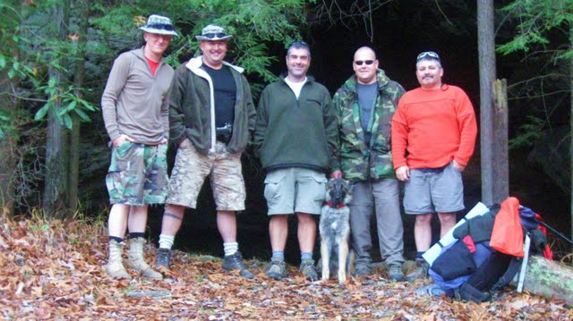
Well Marco, Troy and I headed out to Prentice Cooper WMA for an overnighter. As usual the weather didn't kick in until we reached Mount Eagle. It started with a light rain and gradually got stronger and stronger. Pretty soon I see Troy catching up with me and then pulled up beside me signaling me to pull over. I pulled over at the next exit and stopped at a store. Troy had made up his mind that he was done with this trip. He didn't feel like being wet and saw that the rain was not going to stop for two days. We visited a few minutes and then Marco and I continued on with the "call it at the trailhead system" that we are used to.

We pulled in at the Main Trailhead Parking in a light drizzle. Marco immediately jumped out and said "Let's go!" I said "OK." We signed in at 9:15.

With ponchos on we headed out going counterclockwise around the double loop heading to McNabb Gulf campsite. The rain stayed light with occasional stops until around one o'clock. The trail goes up and down most of the way with rocky trails leading to the multiple creek crossings. There were no views from either Mullen's Cove or Ransom Hollow overlooks because of a fog. We stopped and made a poncho cave to sit in for lunch.

We used the maps off the Cumberland Trail website which we were guessing at around 8 miles. According to the trail signs it came to 8.2 miles to camp. We got to camp at 3pm. The rain had stopped so we started collecting firewood for the night. It didn't take long and we had camp made and a nice fire going. Marco made quick use of his hiking chair, getting comfortable as I used the back rests that someone had taken the time to make at the campsite.

As we fired up the stoves, Marco enlightened me with a new technique. He heated up his water then poured it all over him and the ground. After some words I can't repeat, he started heating up more water. I still don't know what I learned from this, but it has to be good. We ate dinner, took some cough medicine, and told some lies. Marco did entertain me with a fire side dance. I was amazed that at the end of the day that he still had so much energy. I mean he danced. When he finally stopped, he took off his crock and told me that he had an ember go in the hole at the top of his crock.

At around 9pm our relaxing took a break as I had seen a couple of headlamps coming down the trail. It turned out to be a couple of hikers that were looking for camp. They had gotten off work the night before around 10pm and got dropped off at 27. They hiked to Popular Springs Campsite that night and picked up a TTA hiker off the trial on the way in. They had gotten into that camp around 3am and slept in the next morning. They were getting picked up at the Main Trailhead Parking the next morning. We visited a little as they set up camp just down the trail. We never heard from them again. We got a good nights sleep in.

I woke up with the sound of Marco getting the fire started. I got up and eased on over to the fire and got my stove going. I sat down in my makeshift chair watching the fire when I saw a little head peek out from the rocks in the fire ring. Just as I recognized it as a mouse he took off heading between my legs. I jumped up, to Marco's excitement and entertainment, as the mouse went over my seat and out the back. Now, that will get you going first thing in the morning! We ate breakfast and hit the trail at 7:45am.

We got alot of good views today at the many overlooks. We ate lunch at the Natural Bridge, which you really have to climb all over to appreciate it and then headed to Snooper's Rock Overlook. This by far has the best view of all. We then head on to the Indian Rockhouse and Stone Door, before going back to the truck. The trail was pretty much the same ups and downs throughout and in and out of the coves to cross the many creeks. It was a beautiful trail and we would suggest it as a good overnighter. It gives you a pretty good workout too.

When we got to the truck we found a note from the TTA wishing us a great hike with some happy trail dancing. Yes, we did some traditional trail dances on the way. We also met a couple of other hikers that were out for a day hike.

Here are some mileage points:
Parking to Haley road 2.2
Haley road to Hemlock Branch 3.2
Hemlock Branch to Ransom Hollow 1.3
Ransom Hollow to Tower Drive .8
Tower Drive to McNabb Gulf .7
McNabb Gulf to Raccoon Mtn. .8
Raccoon Mtn. to Pot Point Rd. 1.5
Pot Point Rd. to Natural Bridge 2.1
Natural Bridge to Snooper's Rock 2.8
Snooper's Rock to Indian Rockhouse 2.7
Indian Rockhouse to Parking .7

Pictures:

Monday, November 16, 2009

Sheltowee Trace Part I


Trail……………Rating…………Miles…………………….Outcasts Total: 686.0
Day One:
Rock Creek Loop…..Easy…..…..2.25
Sheltowee Trace…….Easy…..….4.35
Total……………………………..6.6

Day Two:
Sheltowee Trace…….Moderate….6.44
Gobblers Arch……..Difficult….…3.86
Total……………………………..10.3

Day Three:
Sheltowee Trace…….Moderate…11

Day Four:
Sheltowee Trace……Moderate….10.9

Day Five:
Sheltowee Trace……Moderate…..5.8

Total……………………………..44.6 Miles

We knew that something was wrong when we actually slept through the night at work. What were the chances that on a planned five-day hike that a hurricane would come to Tennessee? We got up and headed to Big South Fork in the rain.

Greg, Chase, Troy, Shadow, Marco, and I were going to start the Sheltowee Trace. It is a 260-mile trail that runs from the Big South Fork to Northern Kentucky through the Daniel Boone National Forest. We had hiked the first 9.4 miles when we hiked the John Muir trail last season, so we started where we left off and took the Rock Creek Loop trail to get where we needed to start.

Troy, Marco, and I came in one car and signed us all in. Greg got caught up in traffic on I-24 so we didn’t get started until 1pm. We also did a little extra off road driving getting to the trailhead just for practice. You know the Outcast way.

The rain stayed steady as we made our way to Kentucky. This made the trail slick and added the challenge that we always like. Chase and his dad took turns trying to outdo the other with trips and falls. Chase ended up on his back one time. There was one section of trail that was completely washed out and we lost Chase and Troy to slipping and sliding. Then as Greg was attempting to cross a downed tree, he did a fancy dance which one step took out Marco’s hiking pole. He managed to stay up, but the pole was totaled.

The rain did stop by the time we got to our first stop at Great Meadow campground. We forded the river to get to it. We set up camp and Chase actually got a fire going. Some stories were told and cough medicine taken.

The fun started at bear bag hanging time. Greg, Marco, and I gathered all the food and headed to a large tree. The target was a four-inch in diameter branch about fifteen feet off the ground. After a couple of attempts we got the makeshift rope over the branch and attached the bag. The one section of rope was stretching and not sliding over the branch.. It didn’t help that we were trying to lift about two hundred pounds of food. We swapped out some rope and tried again. We finally got our food bags up where we wanted when snap…………….the whole branch broke off the tree. Well, this kinda hit my funny bone a little. The other two started laughing at me laughing and this dragged out for quite a while before we could regroup. Plan B. We found a limb on the other side and took a vote on if this branch was alive or dead. We had to use the branch that broke off to help lift the massive amount of food into the tree. We smiled with joy about the same time that the rope broke. Plan C. We used two ropes and two bear bags and life was good.

The stars came out and we had a beautiful night. Some time in the night the hurricane passed through. I woke up to the flapping of my tarp wondering what was going on. The next morning we collected the articles that had blown away in the night.

Day two started out with a ford across the river. It’s a good way to start the day and get everyone going. We hiked down to where the Gobblers Arch trail intersects. A vote was taken. The Sheltowee crosses Mark Branch numerous times. Troy said about 17 times or we could take Gobblers Arch, which is the high water route. It is described as the driest, but most difficult alternative. I got out voted so up we go. When you got to the base you could look straight up the mountainside and that was your trail. No switchbacks for the half-mile climb. Then you got a short brake before you started going up hill. It added a mile and a half to our hike and kicked some butt. We took a lunch break at Gobblers Arch.

Once we got on Divide road, we hiked the rest of the day on the road. We got our water from the Punchencamp Branch where we saw our first hunter in the woods next to a couple of caves off the North side of the road. We stopped for the night at a large rock shelter with a pool beneath it. It had been used as a campsite before.

We listened to an owl talk as we set up camp and made dinner. After the stories were told and meds taken, the bear bags were hung and everyone hit the sack. I stayed up by the fire and listened to the wildlife. It started with the frogs. They all talked at once then they all stopped about fifteen minutes later. Then the bats took off. I thought that they would come through camp and crap on me, but I just heard them all flapping at once with the high pitch squeaking. After that the birds came through camp. Not sure what they were, but they were perking like Turkeys do. After all that excitement, I went to bed.

Day three; we got off the road. A little while after the initial climb, Greg just hit his knees in the middle of the trail. We assumed that it was time to pray, but we found out that he just fell over a hole in the trail. Then while on break Marco took a picture of Troy and the truth was caught on film. You could actually see Troy’s pack refilling with the lightweight fairy dust that we had all heard about. Lots of climbing today until we finally reached the top with a rock climb and wonderful view.

After we reached the top and ripped our shins on the thorn bushes, we started down. We did some more road hiking and then headed on down to Grassy Creek where we did a little bathing and airing out of the tents and hammocks.

After the break we headed back up the mountain to go back down the mountain and after many creek crossings we went on to the crossing of Big Creek. We got some pictures of Troy carrying Shadow across the creek. The trail then climbs up to and we cross the Yamacraw Bridge. We camped just on the other side of the bridge at a campsite by the Big South Fork Cumberland River.

Greg made connections to get picked up here in the morning. His back was acting up and he had a serous foot injury that let him know that it was time to call it quits. Luckily it happened by a good road and easy to find location.

Stories where told and cough medicine taken by the fire. At bear bag time Chase headed out to a tree to hang their bag. Shortly after he left, we heard some screaming and hollering going on. We all ran to see what had happened to Chase, when in his light beam you could see two sets of eyes bouncing down the trail toward him. What the ___? When they finally came into the light of the other headlamps, you could see that they were two dogs and with the screaming had finally pulled of course and headed through the woods. That was exciting. A short time later we saw some lights up on the hillside and knew that they must have brought the dogs. The people never came down or hollered at us. The lights disappeared and later we could hear the dogs barking up by the parking area. Chase and I made a night hike to check things out and everyone was gone.

More cough medicine was needed. You could have used Chase to mix up drinks with all the shaking he was doing. Finally one by one everyone headed to bed.

Day four; we said our good byes to Greg and Chase and headed down the trail. We hit all the mile markers Lick Creek, Negro Creek, Cotton Creek, and Alum Ford. There is a large flat campsite just past Negro Creek. A shelter, which is not on any map, past Cotton Creek. Alum Ford is a regular campground with roads. We stopped here for lunch and hung everything out to dry. We saw two different deer during this section of the hike.

From Alum Ford we hiked on to Yahoo Falls. The actual fall was not impressive, but the rock formations were. After you hike out of the cove back to the Cumberland there is an outhouse and a flat area by the river to make camp. After this the trail doesn't have any water on it and you cannot get to the river until Big Creek. The trail is rugged in this area and the first camping spot with water is on Big Creek in a rhododendron patch. Here, there was just enough room for the two hammocks and a tent if you have a campfire.

We celebrated our last night out with an overdose of cough medicine. Marco was buzzing. I told the guys that there was good news and bad news. The bad news being that we were at an isolated part of the park, we might see a bear. The good news being that we probably won't hear it because of the river. They felt alot better after I told them that.

We got up the next morning and headed out. There were alot of water crossings and the trail was mostly uphill. We climbed uphill to the swamp and then climbed uphill after that. The area at the start of Big Creek is a waterfall that you hike behind. It is a very beautiful area with the rock formations, but we had some major tree falls in the trail. From here we hiked to 27 where we got to wait for a train before we could cross the tracks. You hike between the church and daycare up the road to get back into the woods. My folks picked us up at the 27 trailhead with some homemade apple pies. Life is good.

Pictures:

Tuesday, November 3, 2009

Fall Creek Falls- Upper Loop II


Fall Creek Falls................................Trail Rating...Outcasts Total: 641.4 Miles
Upper Loop Overnight Trail 13.0 Miles.....Easy

Craig joined us for another hike. He brought his other dog named Hailey this time. Marco, Troy, Shadow and I were ready to hike. Troy picked this trail as we are heading out next week to start the five day section hike of the Sheltowee Trace. It had been a couple of years since we hiked this trail, but it is a repeat.

This year for a change we didn't hike it in the snow and 14 degree weather. The water was up too, so we got to get a couple of water crossings in that we didn't have the last time we hiked this trail.

Once again we hiked it in a clockwise direction, doing the up hill last. Troy decided to twist his ankle right at the beginning just to show how tuff he is. I think he said "anyone can hike this trail on two good legs."

Later on the trail, Craig stuck a foot and a pole in a hole and did the old trail praying on his knees routine. He prays pretty regular, which is a good thing. Just kinda different that he always does it in the middle of the trail while we are hiking.

We had a rather uneventful hike. Just taking in the beauty of nature and that calming thing that the trail does to a person. It was beautiful weather for hiking and that night we had a full moon where we didn't eat even need a flashlight.

We got to camp and collected some fire wood. We did a little maintenance like taking the tree off the top of the outhouse. Troy got a good warm fire going as the temperature dropped down. It got below 30 with the clear sky. The stars were wonderful as we told lies and took cough medicine around the fire.

There was an owl that messed up one of my bathroom breaks in the night. Your body does funny things when you get spooked.

We got up and hung around the fire the next morning. We got on the trail around 8:30 and hiked to the car.

Another beautiful hike.

Pictures:

Monday, October 19, 2009

Piney River Segment- Cumberland Trail-TTA Hike


Trail.....................Rating........Miles.......................Outcast Total: 628.4Day one:
Piney River Trail.…Moderate…..10 miles
Spider Den Spur…..Difficult…….1 mile
Rockhouse Branch..Moderate…...2 miles
Total: 13 miles

Day two:
Piney River Trail….…Moderate…..10 miles
Twin Rock Overlook...Moderate……1 mile
Spider Den Spur……..Difficult……..1 mile
Stinging Fork Trail…..Difficult……..2 miles
Total: 14 miles
Total Trip: 27 miles

This turned out to be a last minute trip by the Outcasts. I was planning on leading a hike for the TTA at Natchez Trace State Park, but could not get any takers. When no one signed up, I decided to hike a trail that I haven’t done yet and got some hikers to join me.

Marco(TTA), Craig, and I(TTA) were going to do the full trail and Lora, from the Soddy chapter of TTA, was going to join us the second day and do a day hike with us.

After a night of running we headed out. It rained all the way to Dayton. My boys had no confidence in my hiking plan. It cleared up, as we got closer. Our first mishap was looking for Shut In Gap road off Hwy 111. It runs of Hwy 68.

Well after we found Shut In Gap road we found out that Walden Mountain Road doesn’t have a street sign. We also found that Forest Camp Road doesn’t have a street sign.

Not sure that we were on the right road we drove it down to Duskin Creek Bridge and then turned around and drove back up to Forest Camp Road. Well the campground doesn’t have a sign either and after some investigation we found the only sign anywhere is at the actual trailhead.

So if you are looking to hike this section of trail, the first left after Stinging Fork Wilderness Area is Walden Mountain Road. Take the first right off that and you will find the unmarked campground on the left. Take the second entrance to the campground and the trailhead will be on your right.

We got on the trail at noon. There is a bridge on this first section that is slippery when wet. I told Marco just in time for him to do some dancing. We were impressed.

We stopped at the first campsite just before White Pine cascades for lunch. We found that there are a lot of campsites that are not on the map. There are two before White Pine cascades. This first campsite has a spring that runs water right through the fire pit in front of the rock chairs that someone has made. You probably would only camp here in dry season.

The trail is beautiful and has a lot of ups and downs. There is a marked spur trail to the North of White Pine cascades that is not on the map and we are not sure where this one goes.

We took the spur trail to Spider Den. This goes steeply down to the river where there are two more campsites that someone has taken the time to make chairs and tables from rocks. You also see the diving platform, which is a flat rock that sticks out over the bluff wall. Spider Den, which luckily doesn’t have spiders in it, is like a large rock house. The trail is about a half mile long. It will take your wind on the way back up to the main trail.

There is another campsite just before Deep Pool Bridge. We took the short spur trail to see Hemlock Falls, which is a very small fall. We were more impressed with the cascades that we had seen.

When you get to Rockhouse branch, the trail cuts off to the right and down. Before you get there you are hiking the old rail bed and if you are an Outcast, you are libel to hike it all the way to where the branch starts. First off we noticed that the trail wasn’t as worn and then finally it ran out all together. We decided to backtrack to find where we missed the turn off.

Pine Branch Bridge is in a little need of repair, but with all the recent rains all the water was pretty.

There are two campsites just across the suspension bridge at the Piney River Crossing. On the way to McDonald Branch Craig took a knee. This was nothing like what the next day would bring. McDonald Branch is a tricky crossing where you might have to do a little tree hugging to get across.

From McDonald Branch to the Twin Rocks Nature trail you look down at the river. Right after the junction you go down to the camp and picnic area next to the river where we stayed the night. We gathered firewood and set up camp. It was time to eat and cold enough to get the fire going. This was the first time that the sky cleared and you could see a million stars. Some lies were told and some cough medicine taken. We had an owl tell us a couple of times to keep it down.

It had gotten below 30 during the night. I got up and started the fire so the other two would get out of bed. Shortly there after, Lora came walking down the trail to camp. We visited while we ate breakfast and broke down camp. The sun was shining and we new it was to be a beautiful day.

We got on the trail and hiked to the parking area and got on the Twin Rocks Nature Trail. We hiked up to the Twin Rocks Overlook for a wonderful sight. The color changes were wonderful with the sun shining on the mountains.

We hiked back to the Piney River trail to enjoy the sights one more time. Lora had hiked the Piney River trail, but none of the spurs or the overlook.

Craig tried to impress Ms. Lora while crossing McDonald Branch. He reached for the tree to hug and then did a backwards somersault over a boulder and landed on his butt against a second one. He did get his arms up in the air for points afterward.

Shortly after crossing McDonald’s Branch Ms. Lora decided to put on her show and landed on her butt after tripping over a rock. She then called out Marco stating that his turn was next. Not to be outdone Marco stepped on a flat rock that slid off the trail and took him with it. He ended up doing a 360 and planting his butt on the ground. I told him to hold still for a picture. He actually ended up with a leg injury that needed some nursing. I did not want to impress Ms. Lora after seeing the competition and gracefully bowed out.

At this time a group of boy scouts hiked pass us that had stayed the night at the Logging campground. They said that they had had a great trip.

We stopped at the suspension bridge for a snack while the sun shined down through the trees above.

We took the Logging camp spur and looped up to the Rockhouse Branch spur which the sign said picnic area. We must have missed the part that went to the campsite. Shortly after that we stopped and ate lunch along the trail.

We hiked the Spider Den spur to show Lora the sights and then continued on. She had also not hiked the trail from Duskin Creek Bridge to Newby Branch campground.

On the way to drop Lora off at her car, we drove by the Stinging Fork Wilderness Area and decided to go ahead and hike that down to the falls and back. This is a strenuous trail, but a beautiful waterfall.

Another beautiful trail to recommend to everyone and a wonderful hike to write about.

Pictures:

Monday, October 12, 2009

Longhunter IV


Long Hunter.........................Trail Rating.............Outcasts Total: 601.4 Miles
Volunteer Trail...6.0 Miles.........Easy
Day Loop............2.0Miles..........Easy
Volunteer Trail...6.0Miles..........Easy
Day Loop............2.0Miles..........Easy
Total………………16.0 Miles

We have numerous folks that say that they want to join us each year. We always tell them, if they have little to no experience, to join us on our first hike of the year to get started. So, after notifying everyone that had mentioned hiking to us, we started off this year with just us. Marco, Troy, Shadow, and me. Craig, who had hiked once with us last year, hike with us this time and is planning on hiking with us on a regular basis. He brought his dog Kuippo.

As per our regular routine, we did a long day and then ran all night at the firehall before setting out to hike. We met at the trailhead and hit the trail at ten o'clock in the morning.

The weather was beautiful and as usual we were ready to get the season started. After the seed tick attack on Marco and I the last hike a week ago, we bathed in DEET before we hit the trail. Then, just as we got our packs on, Troy said "hold on a minute, I forgot something." He went back to his car and pulled out a large cooler which he opened to reveal to us a pile of Troy's famous fried chicken that a show dog couldn't jump over. Well, as usual, being the emotional guy that I am, I started crying at the beauty of it as Troy passed each of us a bag containing a chicken each and some biscuits. He had fried up enough to feed eleven plus us and only about seven ate the night before. Yea, it added three to five pounds per pack, but who really cared?

When we signed in at the ranger station, they told us that a boyscout troop had been out last night. We met them at the split of the day loop and overnight trail. We figured that when we got to camp there wouldn't be any firewood for atleast five miles. From there we really got into the wild flowers. We got into camp at one forty.

We set up camp and collected firewood. We enjoyed the lake and some stories as we waited for dinner time to come. After dinner we got the fire going, and then just before sunset Marco and I hike down to the end of the cove to catch the sunset on film. It was quite the show that mother nature put on for us. You pretty much had to be impressed.

Craig had brought his Sawyer Point One water filter, which we were impressed with. It is a gravity fed filter which really pours out the water. The only draw back that I can come up with is that you have to have a good enough water source to collect in a bag for filtering.

That night, we sat around the fire with our cough medicine and told some lies. We though about keeping up with Marco's words of wisdom. For example: "It gets colder as you walk away from the fire." He might be famous some day.

Some time in the early hours of morning we got some light rain. By morning it had stopped and we had a fire going for breakfast, which also included chicken. We got on the trail at eight thirty this morning and had a beautiful hike out. We got to see squirrels, and those green headed ducks as Marco called them. I had just told Craig that I never see any deer on this side of the park, when we scared off three.

Another fine start of a hiking season. Looking forward to many a snow fall this year.

Pictures:

Wednesday, September 30, 2009

Honey Creek Loop, TTA Hike


Day One:
John Muir 2.3....Easy
John Muir 1.8....Easy
Leatherwood Ford Loop 3.1....Easy
River Overlook 0.2....Easy
Total: 7.4 Miles

Day Two:
Honey Creek Loop 5.6....Difficult
Honey Creek Overlook 0.2..Difficult
John Muir 5.0....Easy
Burnt Mill Bridge Loop 1.4...Easy
Total: 12.2 Miles

Total Miles: 19.6 Miles

This was a Tennessee Trails Association hike that Marco and I went on. We are both members of TTA and we joined Millette and Lora of the TTA.

Plan A: Sara planned this hike as hiking the Honey Creek loop and car camping Saturday night.

Plan B: I suggested we hike Sunday as well and do the John Muir trail. Sara agreed.

Plan C: Sara broke her ankle so Millette was the hike leader and due to rain planned to go the campground Saturday night and hike the Honey Creek loop Sunday.

Plan D: We headed out Saturday morning in the rain and this is how it went:

Because the rain was more of a down pour, we all met up at the Bandy Creek Visitor Center. After a doing a little visiting we decided to hike in the rain as it had changed from a down pour to a light rain. We decided to go for a safe rain hiking trail and picked the John Muir out of Leatherwood Ford to the O&W Bridge. As it turned out with all of the water falls, it was a beautiful hike. There were water crossings and they were quite high as the rain built them up. We found a nice overhang to eat lunch under. It cleared up a bit by the time we got to the O&W Bridge and we got some beautiful views.

On the way back, we decided to take the Leatherwood Ford Loop up to the River Overlook and back to Leatherwood Ford. We were already wet and there was still day light. Millette showed us a few fancy steps today, but nothing like Sunday.

We camped at the Bandy Creek campground, where the girls set up in one site and the boys in the other. We enjoyed some chicken, with Lora's family secret sauce, and tator's. Life was good. We followed up with some marsh mellows over the campfire. Cough medicine was taken and some stories were told.

The rain decided to show up again after I went through all the work of getting the moon and stars to shine. We decided to have a tarp party. We all sat in a row with a tarp over us as we watched the last of our campfire being put out by the rain. The last thing was the car camping as we sat and listened to CD's as the rain came down. Finally we decided to call it a night.

The next morning we got up, had a warm breakfast and headed to the trailhead. Millette was going to do the Honey Creek loop no matter if the water was over our heads. We dropped a car at Burnt Mill Bridge and headed to the Honey Creek trailhead.

Now Millette showed us some moves yesterday, but she was dancing with the stars today. Marco, who was not to be outdone, did a 360 on the trail that was quite stunning. So, I had to show them how to hit the trail and I did a good job.

The trail was challenging with the high water and wet rocks. The water crossings were deep and took a little talent. The trail led us astray a couple of times with inadequate marking. The lizzards were out and even a couple of snakes. The waterfalls were beautiful and we got some wonderful views from the Honey Creek Overlook where we ate lunch.

After the loop we took the John Muir trail to the Burnt Mill loop to Burnt Mill Bridge. The John Muir trial was mostly old road bed until we got to the river. At one point when I was leading, I came upon a large rat snake that not only surprised me, but decided to challenge me as well. He had a little attitude. I turned to Lora who was behind me, but had levitated about three feet off the ground and passed everyone to the back of the line.

We finished up the hike with a good long and deep water crossing where the river had flooded the trail.

We got another surprise when we got back to the truck, as we found that we had gotten into a nest of seed ticks which ate us all up.

It was a great hike. Sorry that Sara couldn't make it, but she was with us in all of our minds.

Pictures:

Wednesday, September 16, 2009